15 Google Earth Finds That Made Viewers Do A Double Take
There’s something oddly addictive about zooming out to spot things most people never knew existed. Satellite views have a way of revealing the unexpected—shapes, patterns, and places that somehow feel secretive even though they’re right there in the open. Here’s a closer look at what the satellite lens has picked up.
Potash Ponds, Utah
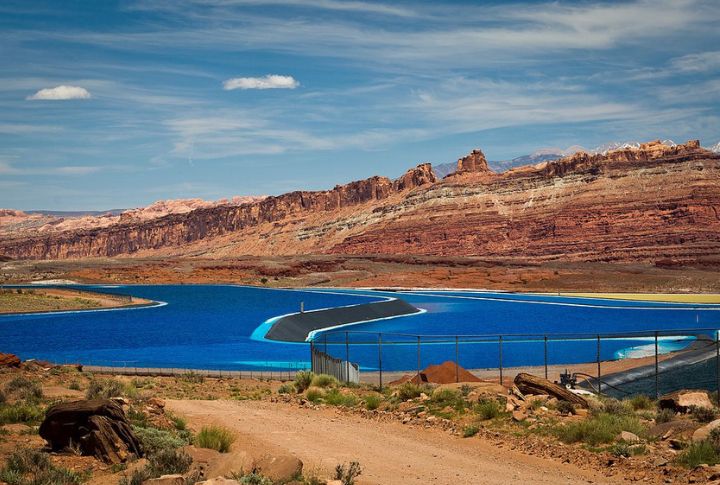
Bright blue rectangles dot the desert near Moab, standing out sharply against the rust-colored terrain. These are evaporation ponds used to harvest potassium-rich salts. The intense color comes from a dye added to speed up evaporation. Their vivid contrast makes them one of the most eye-catching sights in Utah from above.
Area 51, Nevada
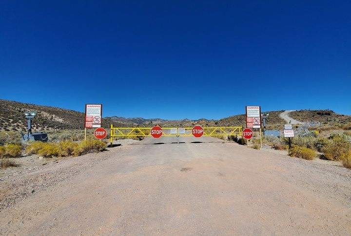
A classified airfield in southern Nevada has long stirred speculation, but aerial views fueled even more curiosity. Area 51 is the name most people use for this facility, which is located within the Nevada Test and Training Range. Despite tight security and limited access, its runways, structures, and desert location remain visible on satellite scans.
Nazca Monkey Geoglyph, Peru
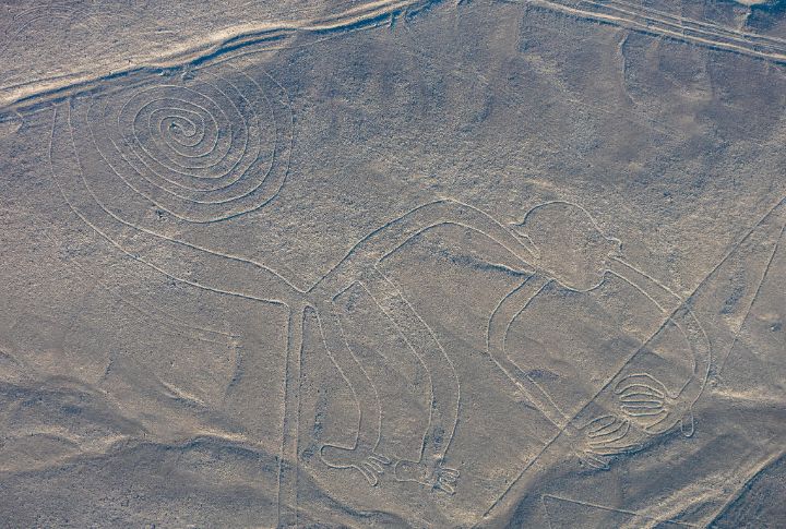
Etched into Peru’s arid plains, the famous monkey geoglyph spans over 300 feet in length. It’s one of the many Nazca Lines, massive ancient drawings best seen from above. Believed to date back to sometime between 500 BCE and 500 CE, the monkey’s coiled tail and exaggerated limbs still puzzle researchers and mesmerize digital viewers.
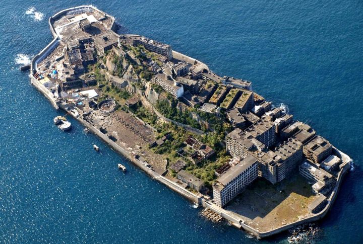
Hashima Island, Japan
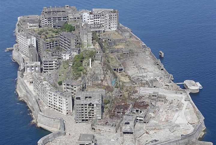
Once a busy coal mining hub, Hashima Island now stands abandoned off the coast of Nagasaki. Nicknamed “Gunkanjima” or “Battleship Island,” it resembles a warship when viewed from overhead. Crumbling concrete buildings and empty streets give it an eerie look, and satellite views highlight its fortress-like shape and isolation.
Airplane Boneyard, Arizona
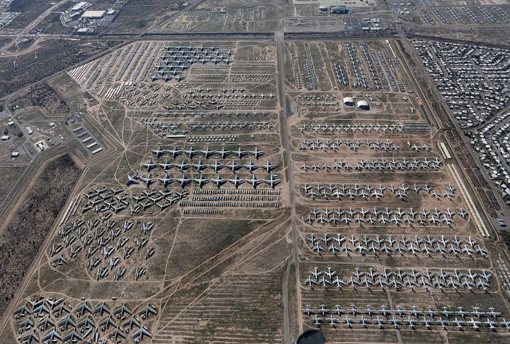
Rows of retired defense planes sit quietly in Tucson at Davis-Monthan Air Force Base. Google Earth reveals more than 4,000 aircraft parked here. Some get stripped for parts, and others rest in the desert heat. It’s the world’s largest airplane storage site, nicknamed “The Boneyard.”
Mysterious Pattern, Kazakhstan

Odd geometric shapes spread across northern Kazakhstan’s plains. Aerial views show huge rings and crosses made from mounds. Called the Steppe Geoglyphs, these ancient earthworks date back thousands of years. Their true purpose remains unknown, but some researchers believe they may have had ceremonial or astronomical uses.
Island Of Love, Croatia
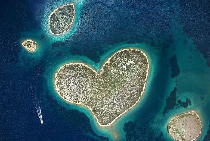
Off the coast of Croatia, Galesnjak caused a stir in 2009 after a satellite view highlighted its perfect heart shape. The uninhabited islet, which measures just 0.13 square kilometers, was named “Island of Love.” Its symmetry continues to attract curious romantics and virtual explorers from around the world.
Ghost Town, Ukraine
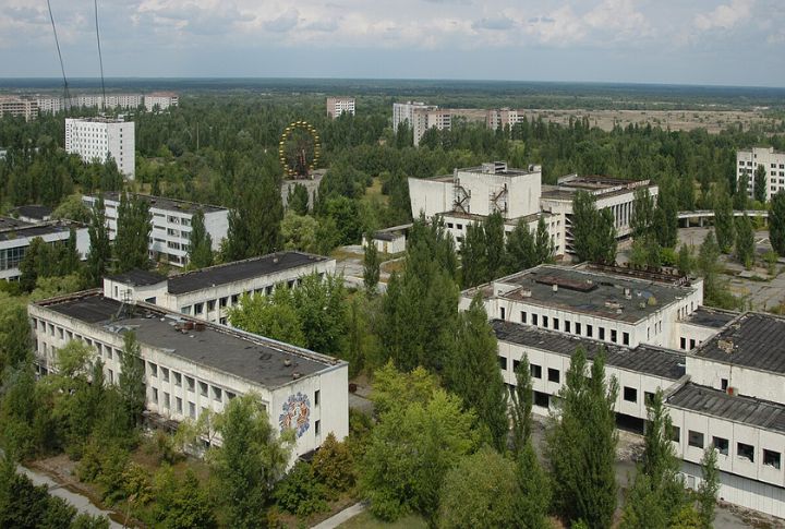
Rows of empty apartment blocks sit frozen in time near Chernobyl. Google Earth images show the haunting remains of Pripyat, abandoned since 1986. Trees grow through buildings, playgrounds sit untouched, rusted Ferris wheels loom over silence, and streets remain eerily quiet. The aerial view captures the scale of the disaster’s aftermath.
Pyramid-like Hills, Antarctica
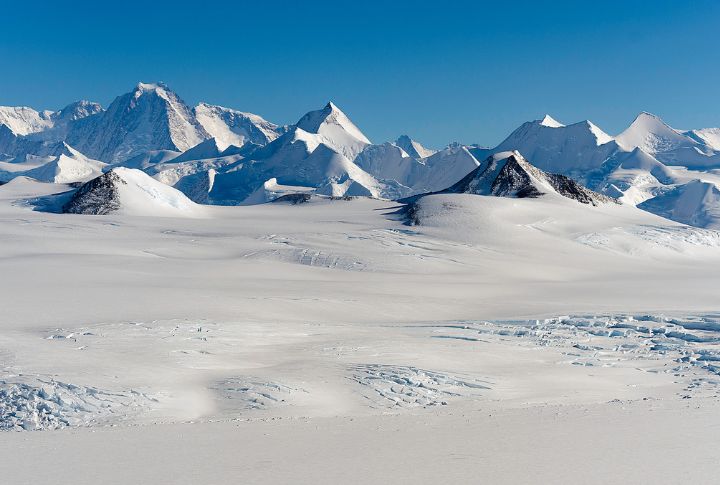
Sharp, triangular peaks stand out among Antarctica’s icy plains. Conspiracy theories jumped in fast, calling them ancient pyramids. Geologists confirmed they’re just glacial nunataks—mountain peaks poking through the ice. Their symmetry looks distinct on satellite images, even if aliens had nothing to do with them.
Floating Forest, Australia
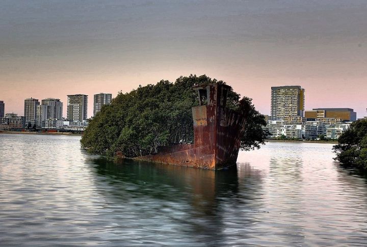
An old WWII-era ship rests quietly in Sydney’s Homebush Bay. Known as the SS Ayrfield, the rusting hull earned the nickname “Floating Forest” after mangroves took root on its deck. Nature took over the abandoned vessel over time, and the result is one of the bay’s most unexpected green landmarks.
Eye Of The Sahara, Mauritania
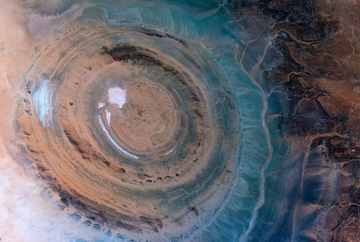
A massive circular formation in the Sahara Desert resembles an enormous eye staring back from the Earth’s surface. Known as the Richat Structure, this 28-mile-wide geological feature was once considered an impact crater. Its precise concentric rings stand out in aerial views and have become a magnet for digital geologists.
Face-like Mountain, Canada
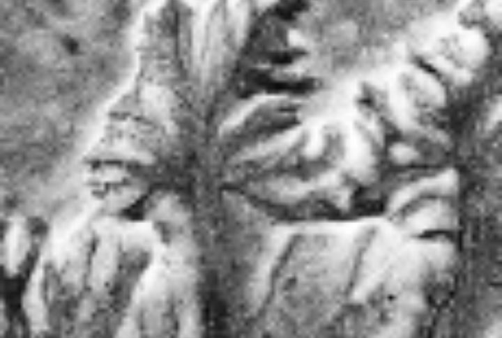
In the badlands of Alberta, erosion created a natural face staring skyward. The “Badlands Guardian” resembles a human head wearing headphones. Satellite views highlight the illusion. A nearby road, not part of the natural formation, conveniently mimics an earbud wire.
Bullseye Lake, Canada
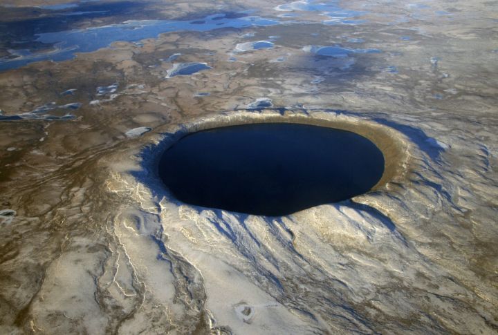
An almost flawless circular lake in Quebec’s remote north marks Earth’s history. Pingualuit Crater formed 1.4 million years ago from a meteor strike. The water inside is so pure that it has almost no dissolved minerals. The bullseye outline stands out clearly in satellite scans, and the circular formation highlights a geological wonder hidden deep in the tundra.
Ice Circles, Russia
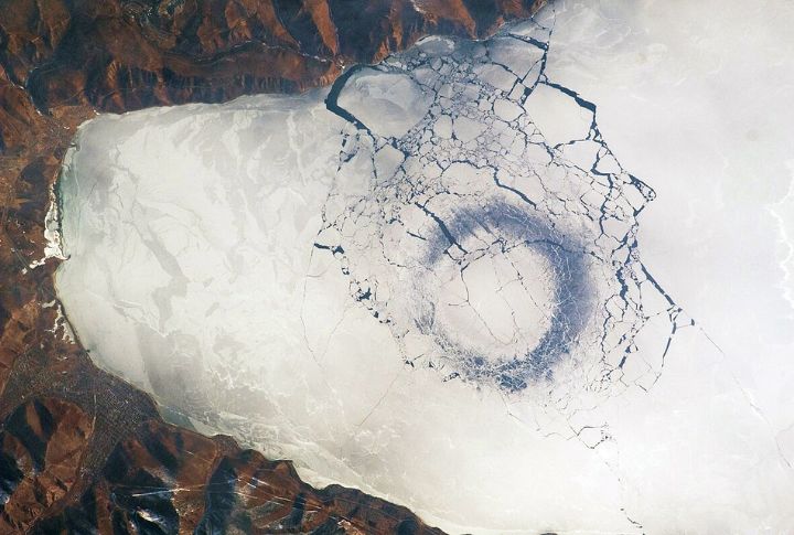
On Siberia’s frozen rivers, swirling circles appear on the surface. These ice discs spin slowly in place, caused by eddies in the water below. Some measure over 50 feet wide. The phenomenon shows up beautifully in satellite visuals and baffles viewers who stumble across them digitally.
Fingerprint Maze, Hove Park, England
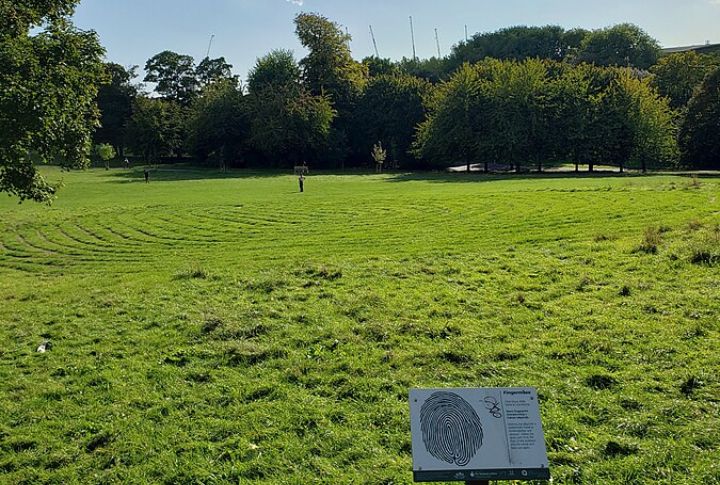
Paths etched into the grass at Hove Park form a giant fingerprint when seen from above. Known as the Fingermaze, it was created by artist Chris Drury in 2006. The labyrinth, designed for quiet reflection, uses stone set into the turf and follows the ancient Cretan spiral pattern mapped onto a fingerprint.